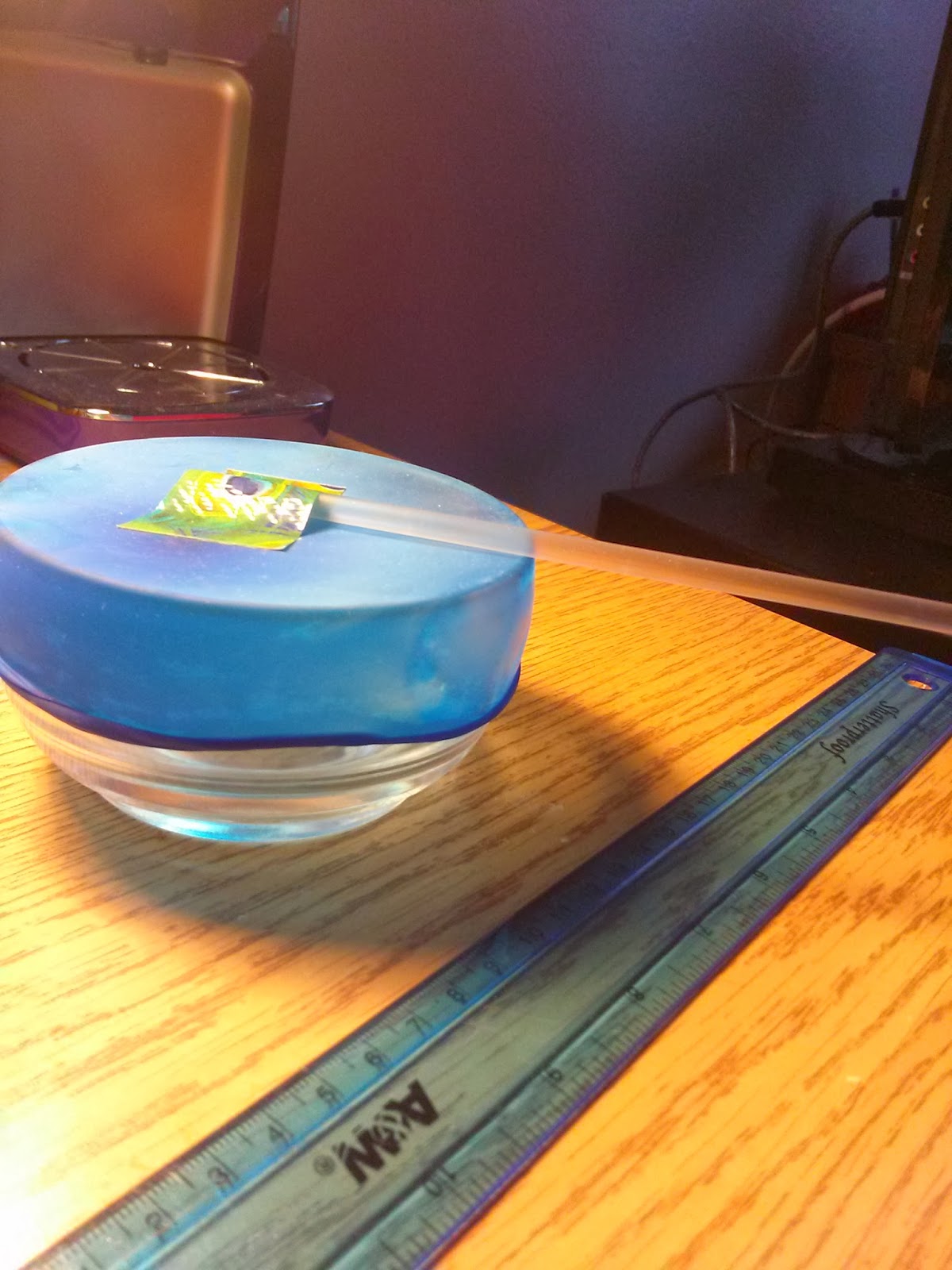
|
| Fred FLINTstone |
There are three main types of rocks, igneous, metamorphic, and sedimentary, each unique in the way it is formed. For example, sedimentary rocks are created by broken down metamorphic and igneous rocks which have been re-cemented together. An interesting sedimentary rock is flint. Flint is a type of quartz with a microcrystalline structure. It typically forms as tiny nodules within other sedimentary rocks. The resilience of flint against wind and water means that it can often be found along riverbanks. Interestingly, these stones were very useful to prehistoric people. They could easily break the flint into sharp points, due to the fractures found running through the rock. This feature made it perfect for building arrowheads and other sharp tools. Not only can flint be used as a tool, but it can also start a fire. Striking a bit of flint against steel will start a spark. Early firearms utilized this characteristic of flint. A large deposit of flint is found in the Flint Ridge Quarries of Ohio. This flint quarry was a favorite of Native Americans due to the flint's beautiful colors.
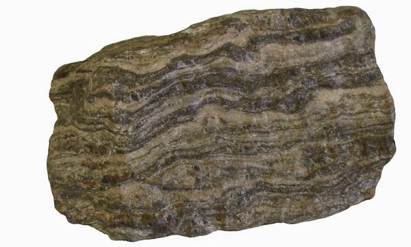
Metamorphic rocks are also created from other kinds of rocks, but for them to be metamorphic they must be subjected to extreme pressure. One of these rocks is Gneiss. Pronounced like "Gneiss to meet you," or "What a Gneiss day." Gneiss can easily be distinguished by the light and dark bands which run around it. It's typically formed when granite and diorite, along with several minerals, are put under pressure. Gneiss does not break into sharp points as easily as flint does, so it has much fewer practical uses. However, Gneiss found in western Greenland is the oldest crustal rocks that we know of. These rocks are nearly 3.5 billion years old. Now those are some "gneiss" old rocks.
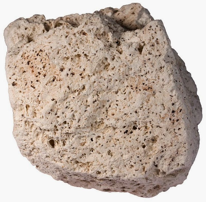
Igneous rocks that don't begin life as other rocks. They are formed by the cooling and crystallization of magma, and although the other rocks may be melted down again, their presence is not very apparent in igneous rocks. Pumice is one of the most distinct of the igneous rocks. It is a very porous and light rock, produced during volcanic explosions. Like flint, it can be used for several purposes, possibly even more than the sedimentary rock. It is used to make light weight concrete, to decorate a garden, and to exfoliate dead skin. When a volcano erupts, pumice will literally rain from the sky, which is what happened in the Pinatubo Eruption. This eruption was the second largest in the world and filled nearby valleys with pumice and ash that went nearly 660 feet deep.
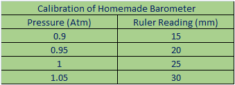
http://www.cals.uidaho.edu/soilorders/orders.htm for a full list of the orders and a small description of each. Soil is typically distinguished by its particle size. We use the social texture diagram to do this.
Soils are another factor in Geology. There are twelve different soil orders that are used to describe the types of soil. See